News in 2023

|
President Diane Dumashie attends 2023 ESRI International Event:
National Geospatial Executive Forum & User conference
8-14 July 2023, San Diego, USA
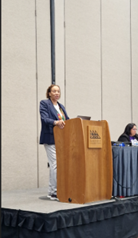
President Diane A Dumashie was invited by
ESRI to attend the ESRI National Geospatial Executive Forum
(NGEF), San Diego, USA 8th July 2023. The forum was held in conjunction
with the ESRI International User Conference (10-14 July 20230) that
attracted over 15,000 visitors throughout the world.
The high-level NGEF of up to 100 leaders from Ministries, Government
departments and leaders responsible for survey, mapping and land
management organisations came together to discuss, share and learn from
each other about applications of GIS to land surveying and wider issues
connected to benefitting society.
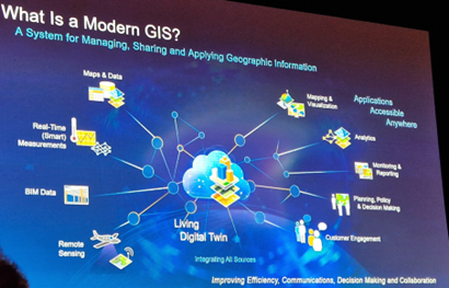
The one-day forum covered topics and discussion associated with the
evolution of the mission of geospatial authorities in the professional
work of Land administration, national mapping agencies, and government
Statistical offices. This inspired discussion about opportunities
and challenges with the esteemed presenters and panellist and involved
interactive audience discussion sharing their perspectives. (See
NGEF
Program)
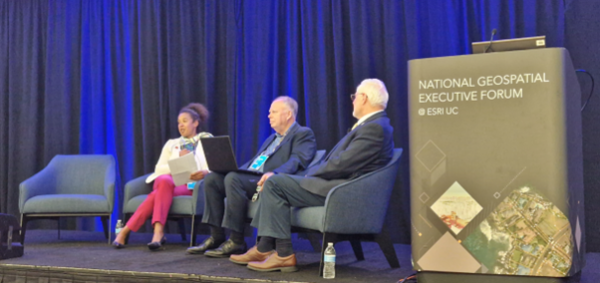
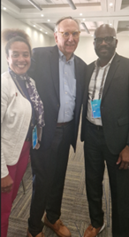
Diane Dumashie FIG, Tim Trainor ICA, Mark Cygan ESRI
In the final 30 minute panel session, President Tim Trainor,
International Cartographic Association, and President Diane
Dumashie FIG, gave their respective summary report of the day’s
take-aways.
Diane Dumashie’ key take aways:
- Commented that much was heard about the progressive evolution,
innovate projects and platforming opportunities with perspectives
supported by the voices of the users.
- Heard insights that addressed two key areas of interest to the
FIG community. Namely, what are the biggest barriers to modernising
our geospatial land and data infrastructure? and
What can be done about improving the agencies mode of working?
Critically modernising is a step-by-step evolution.
- A consistent message is that people are key, and modernization
is through people, in particular noting that the young professionals
is so adaptive to the future way of working
- The key takeaway thought is that as professionals, yes we
capture, yes we convert (analytics) but we do need to be better at
communication.
Participants were further invited to the Senior Leaders forum on the
9th July, attended by circa 300 leaders, and the full ESRI User
conference (up to 20,000 attendees) during Monday to Friday.
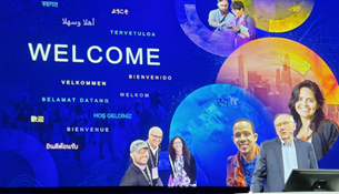
The ESRI 2030 User conference attended by representatives from
commercial sectors, government organisations, academic institutions and
nonprofit organisations come together to share their GIS experiences and
inspire innovative idea.
The 2023 theme “Visualize, Imagine and Communicate’ did not
disappoint. The main highlights were the plenary sessions
headlined by Jack Dangermond, President of ESRI showing
how GIS has a profound effect on our society through the use to design
and mange our resources and help improve our world. This was
followed by the Map Gallery Reception, a great place to network with
industry and colleagues from around the world.
Other plenary keynotes were given by Richard W Spinrad (Under
Secretary pf Commerce for Oceans and Atmosphere NOAA) presenting
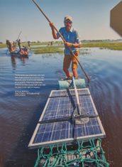
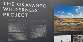
“shaping the New Blue Economy with GIS”; Dr Steve Boyes, National
Geographic Explorer presenting “The sources of life: Exploring the
Okavango Delta’s Watershed revealed more than expected” and many more
presenting on climate resiliency, government operations, infrastructure
modernisation and sustainability.
The week-long activities were packed with presentations divided into
an array of sessions types including; moderated paper sessions a goof
way to see how organizations are successfully using GIS; the Demo
Theaters; and Technical Workshops that look at specific aspects of the
technology; finally, the Special Interest Groups bring users with
commonality (whether topical or by geography, etc.) together to share
experiences, best-practices, and to network.
Dawn Wright ESRI chief scientist, Dr Steve Boyes, National Geographic
Explorer
The Conference had many presentations and events with hundreds of
topics covered. The stand out sessions included the daily focus on Land
records and cadaster sessions and events. And the Esri Science Symposium
hosted by Dawn Wright (Chief
Scientist, ESRI, Prof Oceanography and geography at Oregon State
University and first African American woman to explore the sea bed in a
deep submersible). Through the ESRI science portfolio six science
disciplines can be explored: Open, weather and climate oceans, solid
earth, GIS and social science.
Meeting the GIS community, seeing so many overlaps with our own FIG
survey professional community (across all FIG disciplines) was an
informative experience. Seeing that we have so much professionally, in
common and many opportunities to work in partnership to serve society
for the benefit of people and planet.
Diane A Dumashie
25 July 2023