News in 2024

|
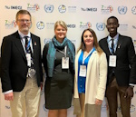
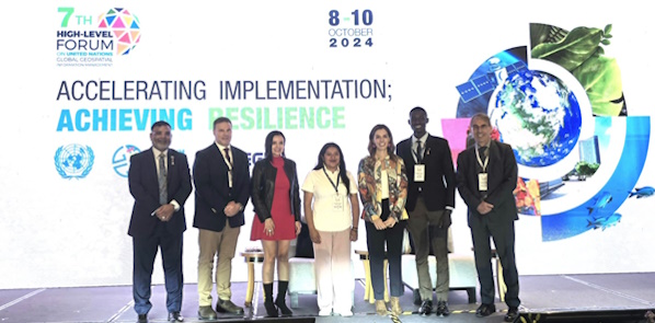
FIG representatives at the Seventh High-level Forum UN-GGIM in México City
October 8 to 10, 2024.
Report by David Elegbede from
The Seventh High-level Forum on United Nations Global Geospatial
Information Management
The theme for the event: Accelerating Implementation: Achieving
Resilience
The Seventh High-level Forum on UN-GGIM 7th HLF was co-organised and
hosted by the National Institute of Statistics and Geography (INEGI) of
the Government of Mexico. It was held at the Sheraton Mariá Isabel Hotel
in Mexico City between October 8th and 10th, 2024. The three-day event
was attended by multi-stakeholders from private, government and NGO
organisations and institutions with over 40 country representatives and
260 attendees.
The discussion was guided by 3 key focus areas for each day;
- Accelerating Implementation for the 2030 Agenda and Beyond
- Achieving a resilient planet with geospatial information
- Building a sustainable future: Innovation, Technology and AI
There was also a series of keynote addresses from top UN officials,
Prime Ministers, Ministers and heads of government agencies. The
keynotes were directed towards the different topics of the day outlining
the challenges and how geospatial information can be used to address the
various challenges by exploring strategies and creating resilience and
sustainable systems where everyone is involved.
 |
 |
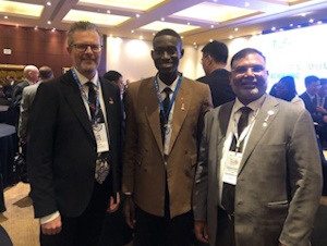
| Mikael Lilje, David Elegbede with Zaffar Sadiq
Mohamed-Ghouse, Vice President Woolpert. |
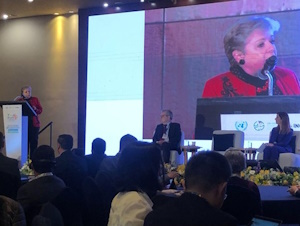
H.E Ms. Alicia Barcena Ibarra, Minister of Environment and
Natural Resources Mexico delivering her keynote address. |
Accelerating Implementation for the 2030 Agenda and Beyond
On day 1, the forum discussed accelerating implementation with the
United Nations Integrated Geospatial Information Framework (UN-IGIF) and
barriers to implementation while preparing for the future. There was
strong advocacy to increase data available for monitoring of SDG by 50%
and from the regional perspective, the need to integrate statistics and
geospatial data as a joint community to improve the availability and
access to geostatistical information needed for the mitigation of
unavoidable challenges.
It was further discussed to move from “measuring the environmental
account to ecosystem account”. The ecosystem approach will help to
measure the extent of every account. One of the panel sessions was
centred on the UN-IGIF with the need to address standards, partnerships
and collaborations. It also discussed the impact of change in
government, governance rotation as a barrier to the implementation of
SDG and the impact of funding in achieving the goals.
Achieving a resilient planet with geospatial information
The forum continued on day 2 with deliberations on understanding and
communicating climate risk using geospatial data, how geospatial
information can be used for climate planning and decision-making,
building geospatial capacity development, and tools and partnerships to
improve climate resilience. The UN GGIM task team presented a report on
geospatial information for climate resilience. The report outlined how
geospatial information can be applied to climate challenges using some
case studies received from member countries. Read more on the report
here
The forum further discussed integrating financial, economic and
geospatial data for financial sustainabilities, with insight shared by
Mr. Bert Kroese, Chief Statistician IMF. How data translation is
important for statistician analysis and how to deal with difficulties in
getting financial support for geospatial infrastructure. The second
session of the day was a charge on “going beyond talking to ourselves”
as geospatial experts, the forum agreed that there is a need to
interpret geospatial information in a manner that is well understood by
the end user and working together to make sure our data works.
The last session of the day was an engagement of Young Professionals and
Women, with David Elegbede for FIG, Maria and Patricia for Youthmapper
and Miriam for Geochicas to share their experiences and the impact of
their collaborative projects. Outlining how the various organisations
strengthen global geospatial information management capacities and what
the global geospatial community can do to develop geospatial capacity,
tools and partnerships to improve climate resilience.
David shared how the FIG has been engaging her members through the
commissions, networks and task forces. Particularly the work and impact
of the FIG Climate Compass Taskforce, FIG Taskforce on SDG and the FIG
Volunteer Community Surveyors Program of the Young Surveyors Network.
highlighting youth engagement and the FIG task in capacity building and
contributions toward the 2030 goals. How the Climate Compass Taskforce
continuous engage across different regions explore innovative solutions,
advocate for sustainable practices, and redefine the role of surveying
in the context of climate change.
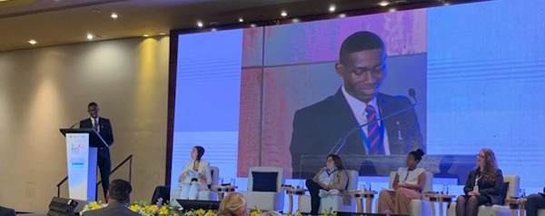
David Elegbede giving a presentation on FIG.
SDG Taskforce awareness among the FIG member associations and Surveying
professionals of how their work, skills and improved expertise can help
to accelerate the process of achieving the SDG’s and the impact of
country level approach and youth engagement using the FIG VCSP
initiative as a case study.
YouthMappers, represented by Maria from Jamaica and Patricia Solis (the
co-founder), also shared some of their engagements and the impact they
have had. The involvement and excitement of youths wanting to
participate and how they were able to build capacity for the youths
through the initiative. This is similar to the work done by the
E-volunteering path of the FIG VCSP. It will be nice to collaborate with
networks with similar initiatives coming together to build a stronger
impact for the FIG Young Surveyors Network.
Similarly, Miriam Gonzelez one of the founders of Geochicas share the
story behind the initiative and how it has been used to bridge gender
gaps in OpenStreetMap and female empowerment using free software and
open data. This is a good collaborative opportunity for the FIG
Commission 7 WG 7.5 on women for land rights leveraging on the skill
sets and networking.
The importance of communities and country-level engagement, bridging
gaps between digital divides, leveraging on the available technology
through AI and relating them to climatic issues, enabling those with
capacity through grants/sponsorship, funding is required to encourage
innovations and creative ideas and collaborative youth engagement and
partnerships. These were key messages passed to the forum. There was
deliberation on having a young professional forum for UN GGIM.
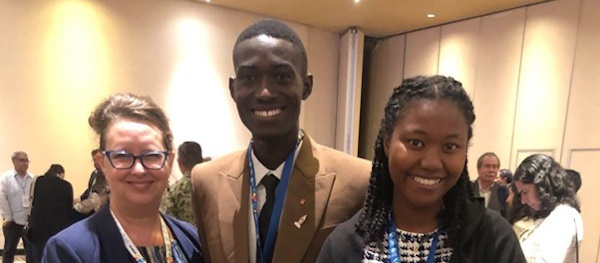
Photo with Youthmappers: Patricia Solis (Arizona
State University, President PAIGH & YouthMappers Co-Founder/Director),
David Elegbede (FIG YSN) and Maria Abigail Timbawala, Leadership Fellow,
YouthMappers, Jamaica Chapter.
Building a sustainable future: Innovation, Technology and AI
Day 3 saw discussions on the future geospatial information ecosystem and
the rise of AI, Big Data, and data analytics in association with digital
infrastructure for the future. The forum started with shared experience
from Mohammed Alsay, President General Authority for Survey and
Geospatial Information, Saudi Arabia and the Minister of the South
African Government shared the country's process of geospatial
transformation.
Leveraging AI (GeoAI) as a means of accelerating response to combating
climate challenges was emphasised. AI data integrity, legal frameworks
and country policies for data security are critical for the efficiency
of AI implementations. The role of AI includes the regulators, enablers,
leaders and users, there is need for data quality and quantity to
achieve a responsive and reliable AI noting the difference between
the Governance of AI and Governance with AI.
The diversity of topics was nice and gave room for a wide range of
thoughts. Deliberation on leadership roles and everyone's responsibility
to achieve the set goals was intriguing. Learning from shared solutions
and inclusivity of multi-stakeholders including the women and youths
gave a balanced audience and thoughts across generations. Networking
opportunities and discussions of local solutions were exciting to note.
Emphasis on collaboration and partnership among all sectors is a
testament that we can move farther if we work together.
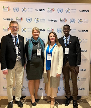
From left: Zaffar Sadiq Mohamed-Ghouse, (Vice President Woolpert),
Joseph Seppi (Senior Vice President Woolpert), Macarena Perez Garcia
(Liaison Director, Institute for Disaster Resilience, Chile), Blanca
Díaz Reyes (young expert, Mexico), Paloma Merodio (Vice president, INEGI
Mexico), David Elegbede (FIG), Stefan Schweinfest (Director, UN
Statistics Division).
Macarena Perez Garcia and Blanca Díaz Reyes were sponsored by
Woolpert, while David Elegbede received sponsorship from both Woolpert
and FIG. We extend our sincere gratitude to Woolpert for making this
opportunity possible.
Report by:
David Elegbede
Contributions by:
Mikael Lilje
Paula Dijkstra
Rosario Casanova
October 2024