| |
FIG PUBLICATION NO. 58
Spatially Enabled Society
Joint publication of FIG-Task Force on "Spatially Enabled
Society"
in Cooperation with GSDI Association
and with the support of Working Group 3 of the PCGIAP
Edited by
Daniel Steudler and Abbas Rajabifard

This publication on “Spatially Enabled Society” is the culmination of a
three-year effort by the Task Force that was established by the General Assembly
of the Federation in May 2009. The Task Force included representations from the
Global Spatial Data Infrastructure Association and Working Group 3 of the United
Nations sponsored Permanent Committee on GIS Infrastructure for Asia and the
Pacific. This is a collaborative effort led by the FIG Task Force and the
publication has been compiled and edited by Dr. Daniel Steudler, Chair of the
FIG Task Force on Spatially Enabled Society, and Prof. Dr.
Abbas Rajabifard, President of the GSDI Association.
The rapid development and increased demand for spatial information
infrastructures in many jurisdictions these past many years have made spatial
information an invaluable tool in policy formulation and evidence-based decision
making. Spatial enablement, that is, the ability to add location to almost all
existing information, unlocks the wealth of existing knowledge about social,
economic and environmental matters, play a vital role in understanding and
addressing the many challenges that we face in an increasingly complex and
interconnected world. Spatial enablement requires information to be collected,
updated, analysed, represented, and communicated, together
with information on land ownership and custodianship, in a consistent manner to
underpin good governance of land and its natural resources, whole-of-government
efficiency, public safety and security towards the well being of societies, the
environment and economy.
The main issue societies have to focus on is probably less about spatial
data, but much more about “managing all information spatially”. This is a new
paradigm that still has to be explored, deliberated and understood in the
context of a spatially enabled society. This collaboration between FIG and GSDI
is within the aim of the MoU signed in 2010 between these two professional
bodies. Together with PCGIAP WG3, this collaboration has allowed for the
participation and contribution from contributors and authors with varied
expertise, from differing backgrounds and in different regions of the world. We
would like to congratulate the FIG Office, members of the Task Force, all
contributors, all co-authors and the two editors for this superb effort. We
extend the deep appreciation and gratitude of our Federation and Membership for
their invaluable and unselfish contributions.
CheeHai Teo
President
April, 2012
Executive Summary
The needs of societies are increasingly of global scale and require spatial
data and information about their land, water and other resources – on and under
ground – in order to monitor, plan, and manage them in sustainable ways. Spatial
data and information, land administration, land management, and land governance
play crucial roles in this.
Spatial enablement is a concept that adds location to existing information,
thereby unlocking the wealth of existing knowledge about land and water, its
legal and economical situation, its resources, access, and potential use and
hazards. Societies and their governments need to become spatially enabled in
order to have the right tools and information at hand to take the right
decisions. SES – including its government – is one that makes use and benefits
from a wide array of spatial data, information, and services as a means to
organize its land and water related activities.
This publication focuses essentially on six fundamental elements, which are
required to realize the vision of a SES:
- a legal framework to provide the institutional structure for data
sharing, discovery, and access;
- a sound data integration concept to ensure multi-sourced data
integration and interoperability;
- a positioning infrastructure to enable and benefit from precise
positioning possibilities;
- a spatial data infrastructure to facilitate data sharing, to reduce
duplication and to link data producers, providers and value adders to data
users based on a common goal of data sharing;
- land ownership information, as the dominant issue in the interactions
between government, businesses and citizens relating to land and water
resources;
and
- data and information to respect certain basic principles and to increase
the availability and interoperability of free to re-use spatial data from
different actors and sectors.
Land and spatial information professionals play a primary role in translating
raw data into useable spatial knowledge resources. These professions should
ensure that both the social and technical systems in which spatial enablement
will operate within are well understood. Spatial enablement can only be
effective when it is designed with the specific needs of the jurisdiction in
mind.
The concept of SES is offering new opportunities for government and the wider
society, but it needs to move beyond the current tendency for the responsibility
to achieve SES to lie solely with governments. SES will be more readily achieved
by increasing involvement from the private sector, and in the same vein, if the
surveying and spatial industries start to look toward other industries for best
practices in service delivery.
Future activities need to take into account emerging trends in spatial
information and the new opportunities they present for the application of
spatial technologies and geographic information. These trends include among
others:
- location as the fourth element of decision-making;
- differentiating between authoritative and volunteered information, yet
recognizing
the importance and value of both types of information towards spatial
enablement and the enrichment of societies;
- growing awareness for openness of data e.g. licensing, and resultant
improvements
in data quality;
- move towards service provision.
Copyright © International Federation of Surveyors and the
Global Spatial Data Infrastructure Association (GSDI),
April 2012.
All rights reserved
International Federation of Surveyors (FIG)
Kalvebod Brygge 31–33
DK-1780 Copenhagen V
DENMARK
Tel. + 45 38 86 10 81
E-mail: FIG@FIG.net
www.fig.net
Published in English
Copenhagen, Denmark
ISBN 978-87-90907-97-6
Published by
International Federation of Surveyors (FIG)
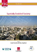
Front cover: Amman, Jordan. Photograph by Robin McLaren,
with cadastral map overlay from Switzerland.
Design: International Federation of Surveyors, FIG
|


