FIG PUBLICATION - EXTENDED VERSION
LADM in the Classroom
AUTHORS
Christiaan Lemmen
Malumbo Chipofya
Andre da Silva Mano
Abdullah Kara
Dennis Ushiña Huera
Peter van Oosterom
Eftychia Kalogianni
Eva-Maria Morscher- Unger
Javier Morales Guarin
Anthony Beck
Stephan Honer
Rohan Bennett
Paula Dijkstra
Jaap Zevenbergen
This work is licensed under
Creative Commons Attribution 4.0 International
FOREWORD
FIG is proud to endorse this publication ‘LADM in the Classroom’.
Building an effective and sustainable Land Administration System requires
coordination among many agencies, each tasked with different functional
roles, including but not limited to land tenure, land use planning, land
valuation, and land development. Consistent and easy exchange of information
is therefore vital. The Land Administration Domain Model (LADM) was first
proposed to support the establishment of a common view on land
administration across agencies involved, facilitating not only information
exchange but also consistency of information across different land
administration functions.
FIG has played a key role in developing the LADM standard, with
contributions from multiple commissions over decades. The first edition
followed an incremental approach, with expert reviews from 2002 to 2006. FIG
submitted a proposal to ISO TC 211, which was accepted in 2008, leading to
LADM's publication as an international standard in 2012.
The development of LADM has benefited from inputs by ISO TC 211 experts
and the LADM Users Community, with findings documented in professional and
scientific publications. LADM adoption is evident from its adaptations into
more than forty country profiles with implementations in ten countries. Its
versatility as a generic land information model is demonstrated by its
specialisation into the Social Tenure Domain Model (STDM). Ongoing
developments are shared through FIG congresses and workshops.
Despite the considerable progress in LADM adoption, there is a dearth of
teaching and learning materials suited for students and practitioners from
the land domain. A major challenge is the gap in technical skills - to be
able to read and correctly interpret LADM models one must understand Unified
Modelling Language (UML) class models which are, to say the least, foreign
to most practitioners and students of Land Administration.
In response, the approach of this book initially eliminates the need to
understand UML class models. The focus is on how information about concrete
Land Administration situations can be structured within a Land Information
System. All materials are based on a singular hypothetical case study giving
the authors the flexibility to demonstrate a wide variety of scenarios. The
cadastral map and other data are made available as a QGIS project enabling
their reuse for teaching and other purposes such as rapid prototyping for
brainstorming or demonstrating ideas. The illustration of LADM concepts
through concrete cases helps the reader to understand how abstract Land
Administration concepts such as rights, restrictions, and responsibilities
can be realized in an actual Land Administration system.
Dr
Diane Dumashie
President FIG
|
|
Preface
The ideas behind this book originate from the our experiences teaching
Land Information Modelling using the LADM in the Land Information Systems
and Models (LISM) course at ITC. During the Covid period we learned that
there is a need for teaching materials that can be used both online and
onsite. This has resulted in this LADM book with a set of presentation
slides. The slides refer to the figures in the book. The book explains
examples of people to land relationships from the map, then their
representation in a database. Finally, the LADM is explained in UML. All
this is further supported by possible exercises in a real database
environment.
This book aims at sharing knowledge and introducing interested parties to
the land administration domain model. The book and figures may be useful in
giving explanations of the LADM in presentations. The contents of the book
can also be useful when making proposals for tests, research or validations
in reports or other documents.
The target audience includes students, teachers, trainers and professors
at universities and vocational schools, designers and developers of land
administration supporting software in governments and companies, and all
those involved in land administration: surveyors, lawyers, conveyors, users
of land administration information and other interested professionals such
as ICT experts.
Christaan Lemmen, Malumbo Chipofya, and Andre da Silva Mano
Enschede, April 2025
Read the full FIG Publication
LADM in the Classroom Extended
version in pdf (20 MB)
Read the FIG Publication 84: The Land
Administration Domain Model - An Overview
This work is licensed under
Creative Commons Attribution 4.0 International
International Federation of Surveyors (FIG), University
of Twente, Delft University of Technology, and Kadaster
April 2025
International Federation of Surveyors (FIG)
Kalvebod Brygge 31–33
DK-1780 Copenhagen V
DENMARK
Tel. + 45 38 86 10 81
E-mail: FIG@FIG.net
www.fig.net
Published in English
Copenhagen, Denmark
ISSN 2311-8423 (pdf)
ISBN 978-87-93914-24-7 (pdf)
Published by
International Federation of Surveyors (FIG)
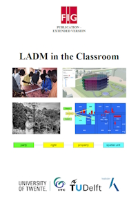
Front cover images:
Upper left: photo by Kwabena Asiama
Upper right: design of the virtual environment and interface by Ping Mao
Lower left: photo by Kadaster International (Liliana Merizalde)
Lower right: design of the fictitious map by Christiaan Lemmen
Diagram at the bottom: Peter van Oosterom and Christiaan Lemmen
Back cover diagram: Abdullah Kara, Peter van Oosterom and Christiaan Lemmen
|